Professional Drone Roof Inspections & Aerial Documentation in Clermont, FL
FAA Part 107 Certified | $1M Liability Insurance | Custom Turnaround | FAA-Compliant Operations
Who we work with:
Roofing companies
Insurance adjusters
Real estate brokers
General contractors
Developers
Why they work with us:
Faster roof inspections
Structured documentation
Risk reduction & reporting
Marketing-ready property visuals
Repeatable aerial site progress updates
We operate strictly under FAA regulations and documented flight procedures.
CORE SERVICES
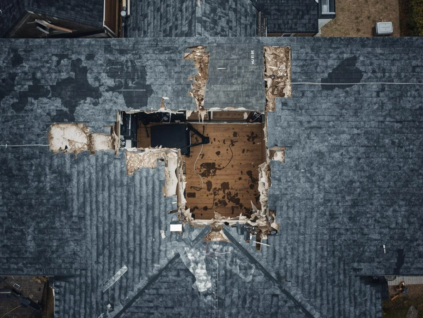
ROOF INSPECTION DRONE IMAGERY
High-resolution aerial roof imaging designed for contractors and adjusters who need fast.
Includes:
Detailed overhead roof imagery
Close-angle condition capture
Organized digital delivery
2–3 day turnaround
REAL ESTATE DRONE PHOTOGRAPHY & VIDEO
Professional aerial media for listings requiring structured, compliant marketing visuals.
Includes:
High-resolution stills
Aerial overview shots
Optional short-form video
MLS-ready delivery
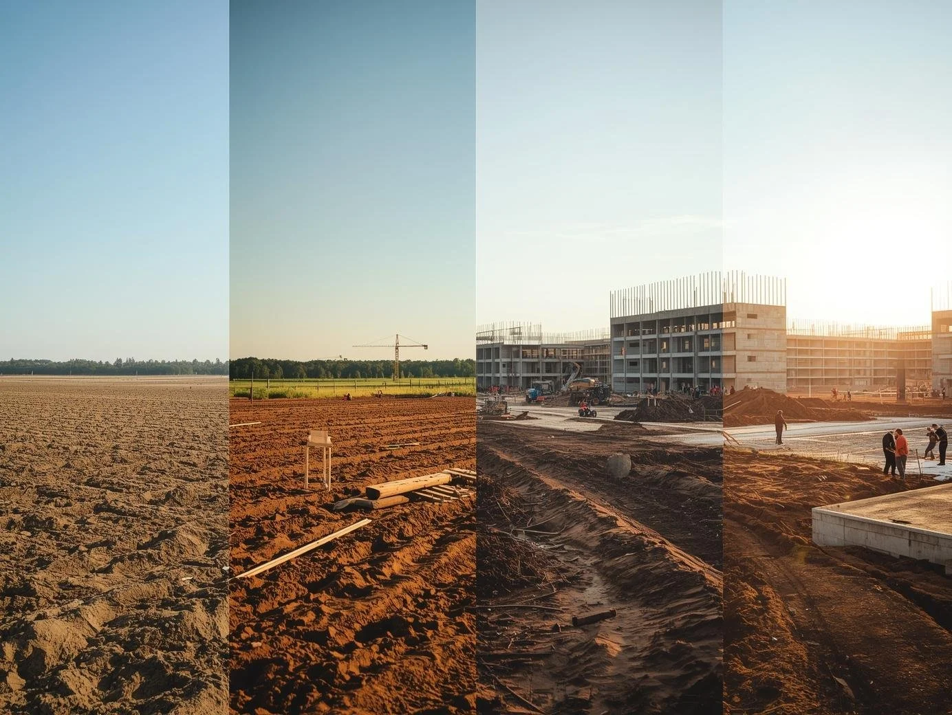
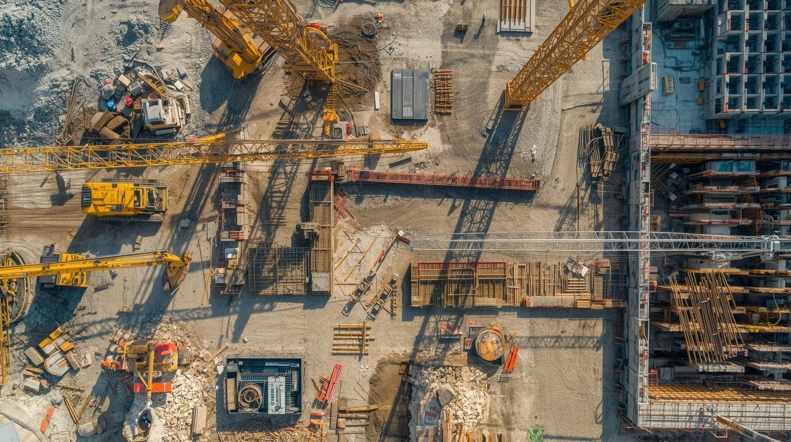
CONSTRUCTION PROGRESS DOCUMENTATION
Repeatable, organized aerial reporting for construction sites and development projects.
Includes:
Scheduled site visits
Consistent capture angles
Progress comparison imagery
Organized archive access
- PRICES WILL VARY BY SCOPE -
Frequently Asked Questions
-
Drone photogrammetry is the process of capturing hundreds of overlapping aerial images and processing them with specialized software to create accurate 2D maps and detailed 3D models. These models can be used for site planning, construction monitoring, volume calculations, and project documentation, providing a clear and measurable view of a property or construction site.
-
The ideal schedule depends on the pace of the project. Many construction teams choose bi-weekly or monthly flights to track progress, document milestones, and maintain a visual timeline of the build. Regular aerial documentation helps project managers communicate progress to stakeholders and maintain organized project records.
-
Depending on the scope of the project, clients may receive high-resolution aerial imagery, orthomosaic site maps, 3D models, and structured image documentation. These deliverables can be used for planning, reporting, marketing, inspections, or project management.
-
Turnaround times vary depending on the size of the project and the type of deliverables requested. Real estate photography is typically delivered within 24–48 hours, while photogrammetry models and construction documentation may take a few additional days due to the processing required to produce accurate mapping and 3D models.
-
In most cases, no special permission is required from the client, but all flights must comply with FAA regulations. As a licensed FAA Part 107 operator, LumaTerra Aerials handles airspace checks, flight planning, and compliance to ensure every operation is conducted safely and legally.
-
Working with LumaTerra Aerials is designed to be simple, professional, and dependable. Each project begins with a brief consultation to understand your site, timeline, and deliverables. From there, we manage flight planning, airspace compliance, and structured aerial data capture to ensure accurate and consistent results.
We stay engaged throughout the entire process, working alongside our clients every step of the way to maintain transparency, build trust, and ensure every project need is met. Once the flight is complete, all imagery and data are organized, processed, and delivered in a clear format ready for documentation, planning, marketing, or reporting.
We Operate Like a Business, Not a Freelancer
Most operators over-promise and under-deliver
We focus on defined scope, documented processes, and transparent communication
Our Process:
Pre-flight compliance check & airspace verification
Structured capture plan
Organized image processing
Post-flight quality review
Delivered assets with clear labeling
We emphasize compliance, communication, and consistent output.